|
| *****SWAAG_ID***** | 154 |
| Date Entered | 10/03/2011 |
| Updated on | 10/03/2011 |
| Recorded by | Tim Laurie |
| Category | Settlement |
| Record Type | Archaeology |
| Site Access | Private |
| Record Date | 01/01/2005 |
| Location | How Hill, Low Whita. |
| Civil Parish | Grinton |
| Brit. National Grid | SE 0025 9833 |
| Altitude | 212m |
| Geology | Terminal moraine. |
| Record Name | Defended settlement on How Hill, Low Whita. |
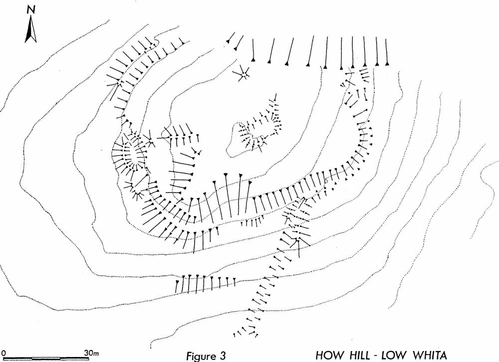
| Record Description | See plan, Swaledale Ancient Land Boundaries project, Ninth Interim Report, 1992, Figure 3.
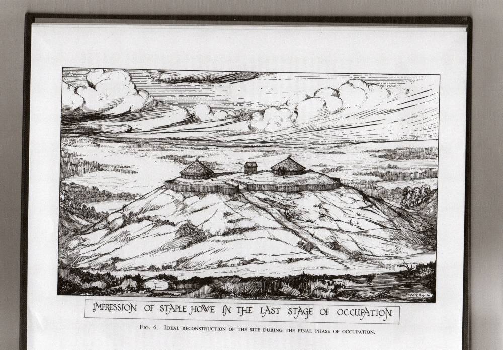
Hill Top enclosure defined by a prominent encircling earthwork which is not really a ditch or a bank or an obvious palisade slot. On balance of probability this earthwork is likely to be an infilled palisade slot. If so, this site may be comparable to the Iron Age defended habitation site at Staple Howe (Brewster, T.C.M. 1963). Occupation of the Staple Howe palisade defended settlement was dated from 600BC to 400BC. This is also the period of the development of the earlier phase (The Reeth System) of the coaxial field systems on Calverside. The density of platform settlements on both sides of the Swale points to a very substantial population in Mid-Upper Swaledale at this time.
The �palisade slot� is slighted by a later field bank and by subsequent cultivation.
The dating of earthwork settlements on morphological grounds is fraught and several chronologies are possible, including roman or an early post roman occupation. Indeed it would be to be expected that this prominent site was first occupied during prehistory and reoccupied at different dates subsequently.
The apparent absence of house platforms within the enclosure does not preclude the presence of timber houses. The visible rectangular building, see plan, points to reoccupation of the site at a later date
The complex entrance earthworks on the western side points to a gateway here. The slanting trackway on the south side may lead to a secondary access over or through the palisade or later access unrelated to the palisade.
|
| Additional Notes | The nature of the apparent defensive palisade, entrance and internal features can only be determined by excavation. On balance of probability, this site provides a close parallel with the palisade defended Iron Age settlement at Staple Howe, Knapton, near Malton, East Yorkshire.
References:
Brewster, T.C.M. 1963. The Excavation of Staple Howe. The East Yorkshire Archaeological Committee.
Fleming, A. and Laurie T.C. Swaledale Ancient Land Boundaries Project, Ninth Interim Report, 1992, Figure 3.
Fleming, A. 1998. Swaledale Valley of the Wild River. Figs 8.5 and 8.7
|
| Image 1 ID | 421 Click image to enlarge |
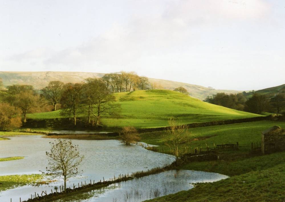
| Image 1 Description | How Hill and enclosure from west | 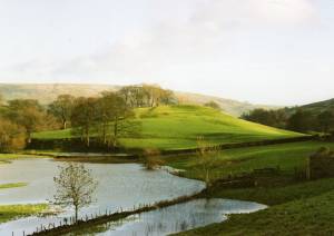 |
| Image 2 ID | 422 Click image to enlarge |
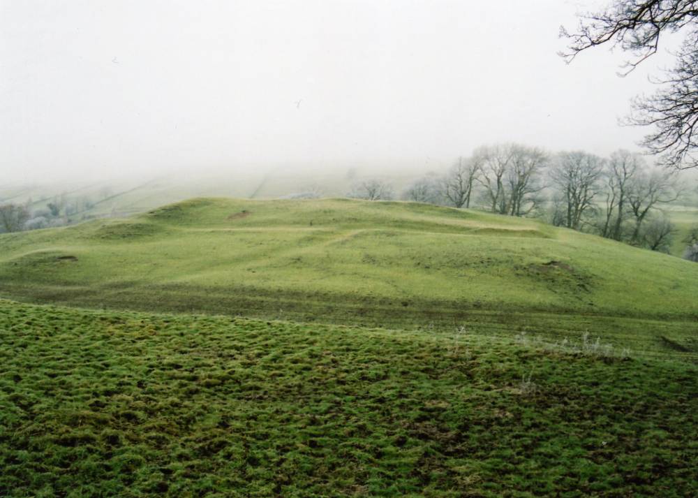
| Image 2 Description | How Hill and Enclosure from Low Lane, Low Whita | 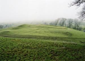 |
| Image 3 ID | 423 Click image to enlarge |
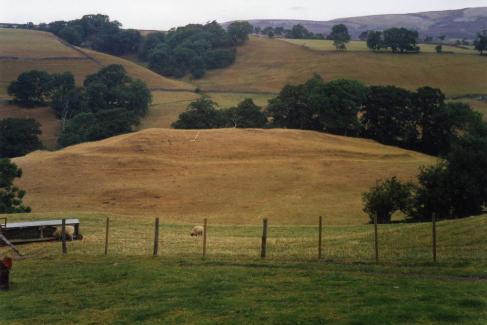
| Image 3 Description | How Hill and Enclosure from Low Lane, Low Whita |  |
| Image 4 ID | 424 Click image to enlarge |
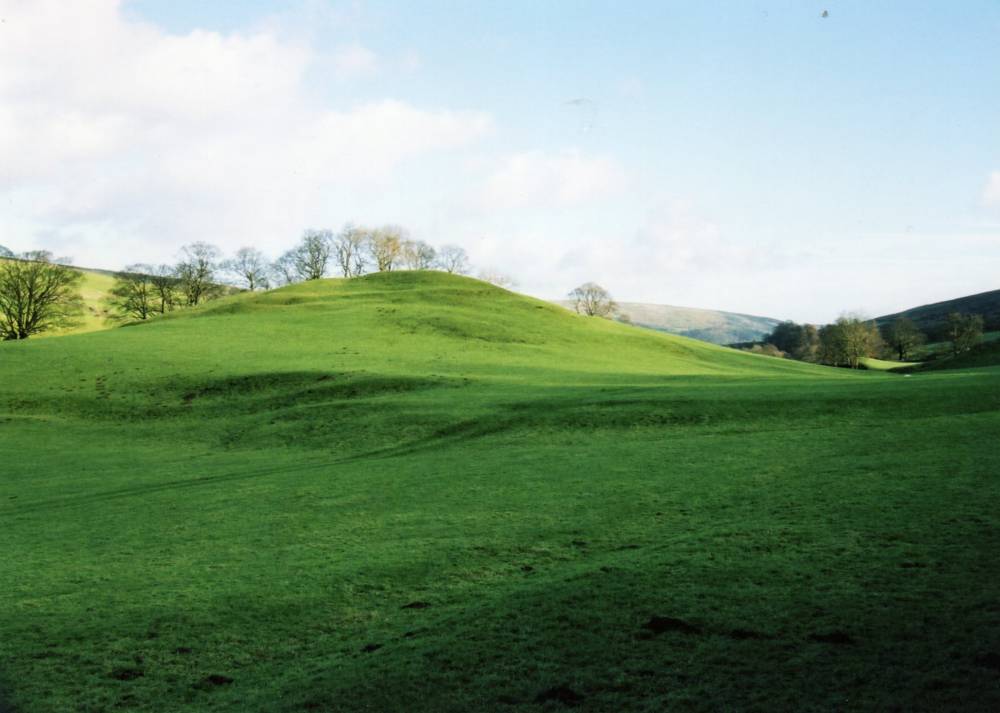
| Image 4 Description | How Hill and Enclosure from Low Lane, Low Whita |  |
| Image 5 ID | 425 Click image to enlarge |
| Image 5 Description | How Hill and Enclosure. SWALB Survey Plan. Fleming and Laurie, 1992, Figure 3. |  |
| Image 6 ID | 426 Click image to enlarge |
| Image 6 Description | Staple How defended settlement. Reconstruction from Brewster, T.C.M 1963. | 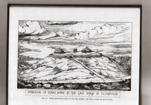 |